Adrián Cidre
Home
Posts
Courses
About
Posts
Categories
All
(6)
R
(5)
databases
(1)
forestry
(2)
ggplot2
(3)
packages
(1)
personal
(1)
rayshader
(2)
spatial
(3)
wildfires
(2)
Order By
Default
Title
Date - Oldest
Date - Newest
3D Population Spikes Map - Norway
9 min
R
rayshader
spatial
In this post, we will create an amazing spikes population map for the country of Noway using the awesome
rayshader
R package.
Jan 7, 2024
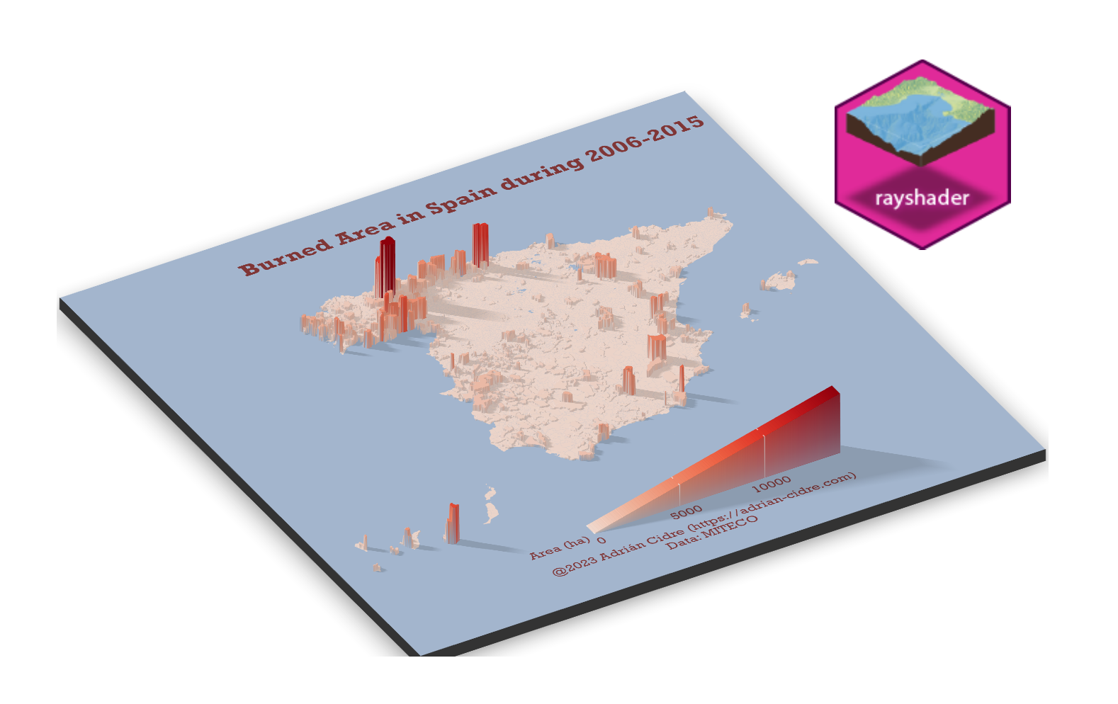
Spanish Burned Area during 2006-2015 by Municipality
7 min
R
forestry
wildfires
ggplot2
rayshader
In this post, we will explore the distribution of the burned area in Spain by municipality creating a 3D visualization using the awesome package
rayshader
😎.
Dec 31, 2023
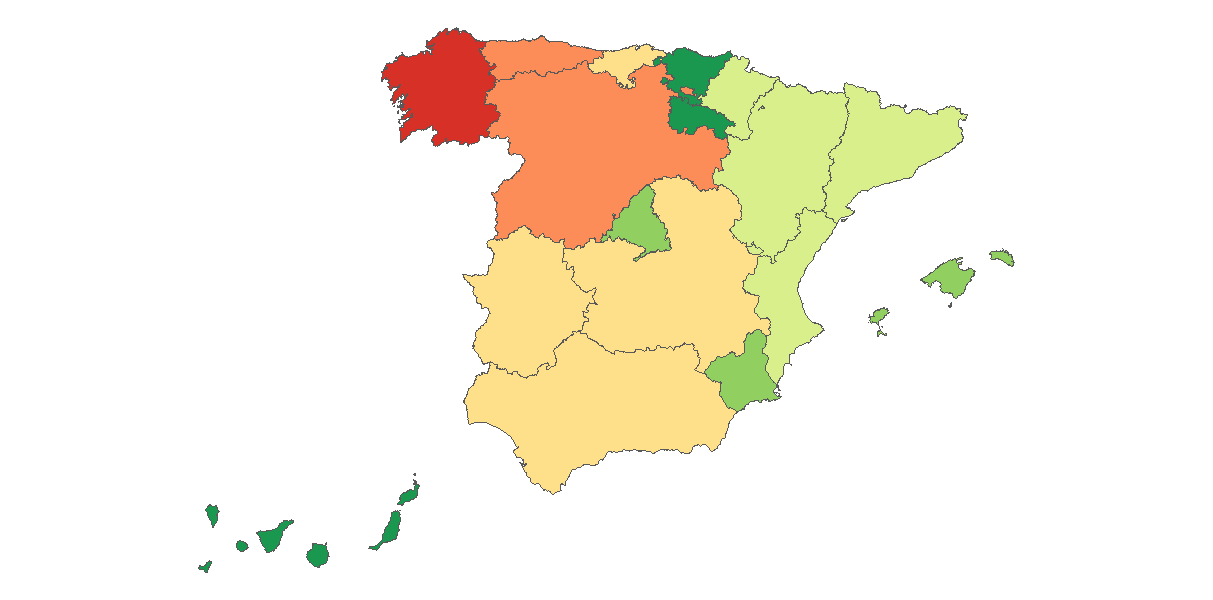
Spanish Wildfires by CCAA during 2006-2015
9 min
R
forestry
wildfires
ggplot2
In this post, we will explore the distribution of the forest wildfires in Spain by Autonomous Community, creating some descriptive graphs using R and
ggplot2
.
Nov 18, 2023
rpostgis is back
5 min
R
spatial
packages
databases
The
rpostgis
package was born around 2016, and since then, more than 20 versions have been released to CRAN (the official R repository). However, the geospatial ecosystem in…
Oct 20, 2023
Choropleth map
6 min
R
spatial
ggplot2
In this exercise, we will create two choropleth maps using
ggplot2
:
Sep 30, 2023
Presentation
2 min
personal
My name is Adrián Cidre González, and I hold a degree in Forestry Engineering from the University of Santiago de Compostela. Currently, I am pursuing my master’s degree in…
May 29, 2023
No matching items